
The Landscape and Urban Development of L’Estartit
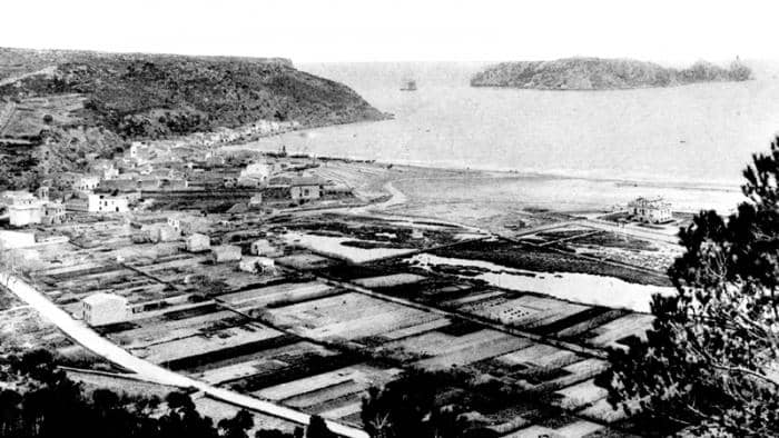
The landscape of L’Estartit has significantly influenced its urban development, with the town being bounded by mountains, the plain, and the sea.
When L’Estartit was first established, the River Ter flowed much closer to the town, where the Ter Vell wetlands are located today. In order to protect the homes from the stormy seas, floods from the river, and the mountain range’s winds, the town was built at the foot of the mountain.
This location, nestled between the mountain and the sea, also posed challenges for rainwater drainage. The rainwater from the mountain torrents was prevented from flowing freely, which led to the creation of small separations between every 4 or 5 houses, known as transverse chains. These transverse chains not only allowed the water to flow through but also served as shortcuts for people to move from one street to another, shortening the path to the sea.
The chains are a clear example of the strong relationship between the landscape and urban planning in L’Estartit, showcasing how the natural environment shaped the town’s development and the solutions the community created to adapt to it.
Audio guideFollow us on the Social Media


 Home
Home


